<img height="1" width="1" style="display:none" src="https://www.facebook.com/tr?id=1552095988155819&amp;ev=PageView&amp;noscript=1">
contact us
language

News


New! Narragansett Bay high resolution tidal model

Posted by Penny Haire on 23 September 2020 10:12:43 AM
Penny Haire

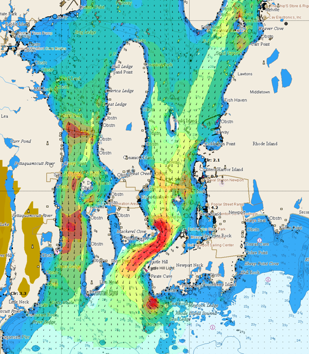
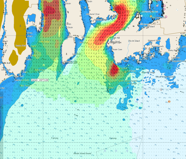
Due to high demand we have released a limited edition high resolution tidal model for Narragansett bay and Rhode island Sound in time for the Rolex New York Yacht Club Race Week.  The region covered includes all racing areas in the Bay and to the South at 110 m resolution at 60 minute intervals.

Data is available as GRIBs or PDF images like the ones below, for the North and South race areas.

Narragansett Bay tide

Narragansett Bay tides South

How to get GRIBS and / or PDF's

    1. Purchase an advanced subscription
    2. A link to the PDF's will be in your email receipt
    3. Download GRIBs from our website (at the very bottom of the /data page) or via Expedition software

LIS - data


Get Gribs Now

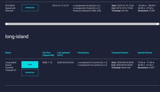
The full Long Island Sound model will be made available on a regular basis in a few week's time.


Topics: sailing, yacht, tidal model, high resolution model, yacht race, NYYC, Narragansett Bay

Download the Ocean

High resolution metocean data from the world's foremost ocean scientists


Long Island Sound CTA3


View accurate and detailed online maps of tidal and ocean currents, waves and wind with Tidemap, or integrate our unique data services with your application. 
Advantages:

  • Unique high resolution tidal currents - only available from Tidetech
  • Wide range of scientifically validated wave and weather data
  • Forecast and historical data
  • Enterprise grade cloud based data services via high capacity API's

Find out More!

Recent Posts