For anyone that wants to start out using meteorological data for a planned application, it can seem daunting to look through all the different sources to try and figure out which one is best for your circumstances. A wide variety of options includes government-funded models, models from research institutions and also commercial and private institutes. So which is the best model?
Global Sources
- the NCEP GFS (U.S. National Centre for Environmental Prediction - Global Forecast System, NOAA)
- the ECMWF (European Centre for Medium-Range Weather Forecasting
- the CMC (The Canadian Meteorological Center)
- the FNO (U.S. Navy Fleet Numerical Meteorology and Oceanography Center)
- the UKM (United Kingdom Met Office)
- the DWD (Deutscher Wetterdienst - from Germany)
How to Select the Best Weather Data Source for You
The U.S. National Atmospheric and Oceanographic Administration (NOAA) provides a website which offers statistical comparisons between models based on their past performances, on a rolling basis. It's quite technical at first sight, but an excellent place to start is selecting Murphy's Skill Score for a parameter such as wind and examining how the various models compare. The Y-axis is the score (with one being perfect), and the X-axis is the time in hours -i.e. from 1-10 days.
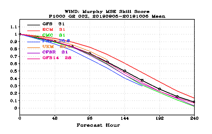
As you can see, for the period shown here (2019-09-05 to 2019-10-06), most of the models perform pretty much the same until days 3 or 4 (hours 72-96), after which the ECMWF (ECM) model (red line) performs marginally better than the rest until day ten. The FNO model performs the least well of all models. The fact is, after 5-6 days, none of the models performs exceptionally well in real terms with an average 50% accuracy. After this point, you might as well toss a coin or start looking at climatological averages if you want to know what to expect in week two of the forecasts.
The hierarchy between the models changes all the time, depending on how each model has been initialised, and how it responds to a particular given set of circumstances at a point in time, so it's worth checking in on the comparison website before you decide which model to use on a particular day.
Accuracy across the globe is not uniform either, as understandably, the scientific focus for each nation is to ensure that their model is accurate for their own particular country.
Another significant point to remember is that observations drive atmospheric models, and whilst satellites provide global coverage, they can't observe the 3D structure of the atmosphere like a radiosonde (weather observation balloon) can. Balloons are deployed from hundreds of airports around the world every day, and aircraft and ships also take weather observations.
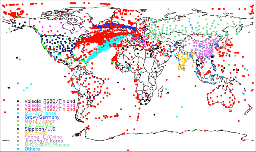
Global Observations from Radiosond Stations and Ship reports.
However, much of the world is still not covered, particularly the southern oceans. The outcome is that atmospheric models are often demonstrably less accurate in these parts of the world. Here is an informative overview of collected observations provided by the World Meteorological Organisation.
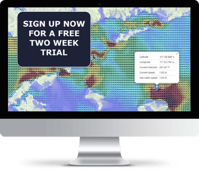
Free Trial of Weather Data Sources for Application Developers
At Tidetech, we provide a FREE trial of the available data sources.
If you are still unsure about what source works best for you, this will give you a chance to test various sources before making an executive decision to sign up to a specific plan.
From here, we'll help you to easily integrate data into your application with the Tidemap platform and easy to use APIs.
The platform allows you to easily navigate through the available data tools, filter and other navigation options. You can then select the data you need specifically to store in your local drive and implement into any application on your own accord. We also have various plans that can suit your needs best, allowing access to the latest forecasts, data downloads and interactive map displays.