It’s been three years since we released the Singapore and Malacca Straits 800m high resolution tidal model. This model benefits vessels using route and speed optimisation systems in this busy stretch of water by taking advantage of accurate tidal speed, direction and height data to create bunkerage savings..
We’ve now updated this model to incorporate the influences of weather – wind and atmospheric pressure – and ocean surface height differences across the model region. This is a very important step since the monsoon in South East Asia has a profound effect on the ocean dynamics in the region, creating, in effect, a slope across the model region with persistent high water one side of the Straits and low water on the other.
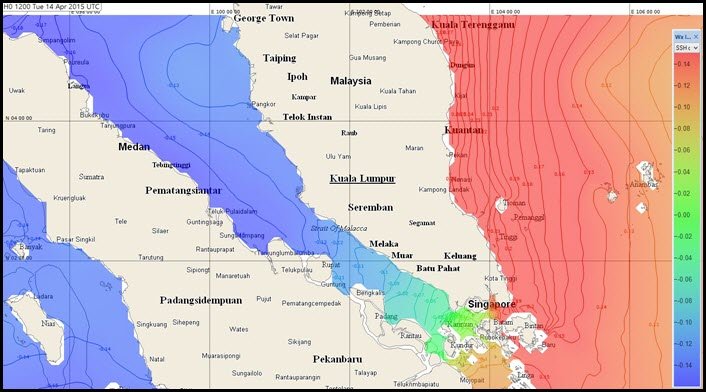
Image shows higher level of water on east side of Straits creating persistent flow to the east
On average, between December and March, the north east monsoon creates an east to west slope with resulting enhancement of westerly current in Singapore Strait and north westerly flowing current in Malacca Strait of between 0.5kt to 1kt. Between April and November, the south west monsoon creates a west to east slope with resulting enhancement of easterly current in Singapore Strait and south easterly current in Malacca Strait of between 0kt to 0.3kn.
Our upgraded model now combines these effects with the underlying tidal dynamics. The result is a tide-surge forecast – the most accurate possible simulation of actual conditions.
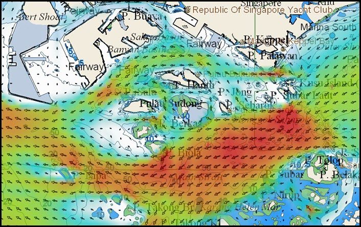
Grib file of Singapore Straits tide surge model as viewed in Adrena Software