We are very excited to release our new model of Long Island Sound. With a resolution of 110m the model covers whole Sound in incredible detail, showing for the first time how the tidal currents flow around key locations across the region.
A Navigator's Racetrack
Long Island Sound is a fascinating and challenging place where strong and complex tidal currents and a mixture of wind conditions are a test for even the most experienced navigators. This year the tides will be especially important as the race will be just after the full moon - and so big, Spring Tides up to 4 kts in places.

Key locations
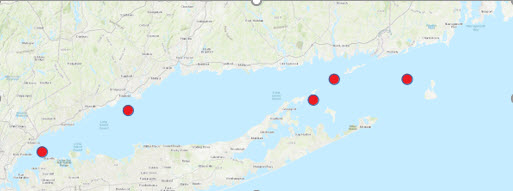
Regular competitors will already know how vitally important the following locations are to the result:
- The Race (passage between Little Gull Island and Fishers Island)
- Plum Gut (passage between Orient Point and Plum Island)
- Block Island
Watch this video to see how the currents flow as the tide changes:
Model Facts
- Resolution - 110m
- Time steps - 30min
- GRIB files available
- Tested in Expedition and Adrena, Time Zero etc.
Model Construction
High-quality bathymetry (depth information) is fundamental to model accuracy and thanks to NOAA's National Centers for Environmental Information, we have obtained some of the highest resolution bathymetries we have ever seen, down to 3m resolution in places.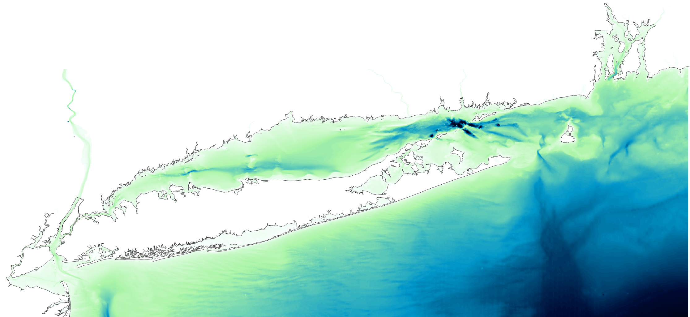
There are many complex, shallow inlets and rivers across the model area - intertidal areas where the seabed covers and uncovers with the tide. Previously, these areas were not well represented in bathymetric datasets due to the difficulty of measuring the depth in very shallow water by boat, with sonar. LIDAR has solved this problem, and now bathymetric measurements in intertidal locations are made from the air by overflying the area in a light plane equipped with LIDAR.
Several bathymetric sources were harmonised, merged and resampled to a 0.001 deg (110m) resolution grid. This is used as one of the inputs to our modelling system and the model is run on one of our High-Performance Computers.
Accuracy
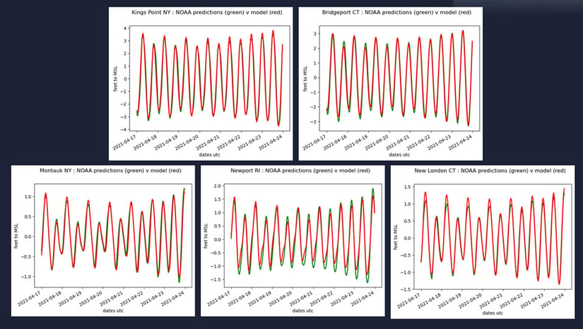
We have compared the model to NOAA observations for Height at a selection of Ports, and currents where NOAA current meters are located.
Tidal Heights
Tidal Currents

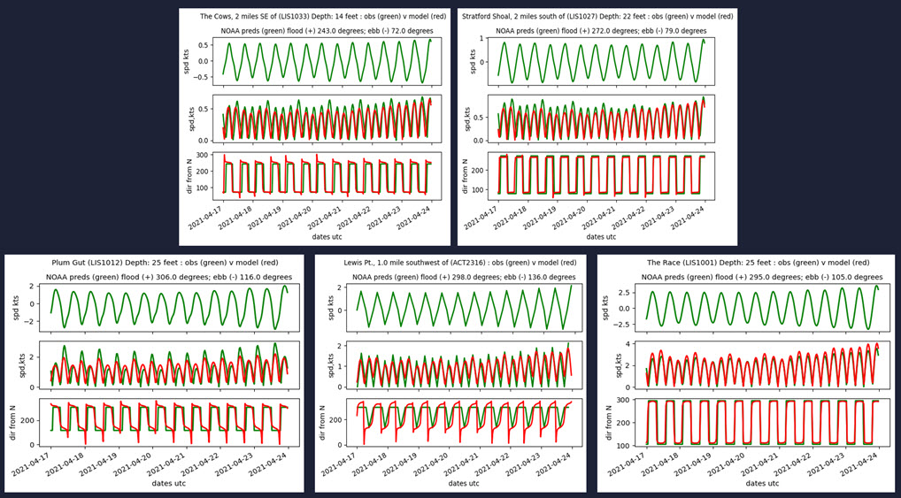
The 'observations' come from the NOAA Ports website (https://tidesandcurrents.noaa.gov/).
How to get GRIBS
-
- Purchase an advanced subscription
- Download GRIBs from our website (at the very bottom of the /data page) or via Expedition software