Traditionally, there has been little tidal information available to the public other than height predictions for major (standard) and minor (secondary) ports; even fewer tidal current predictions are available to Mariners other than a limited number of tidal diamonds and tidal stream atlases. These data have traditionally been published by official sources, such as Hydrographic Offices.
Although useful for indicating conditions at the start and end of a journey, this data on its own doesn't provide the level of detail that mariners need for their chosen waterborne activity. In this article, we cover the traditional methods for tidal measurement and their shortcomings and modern technological advancements that can revolutionise the maritime industry in terms of tidal information.
The value of Tidal Observations for predictions and their limitations
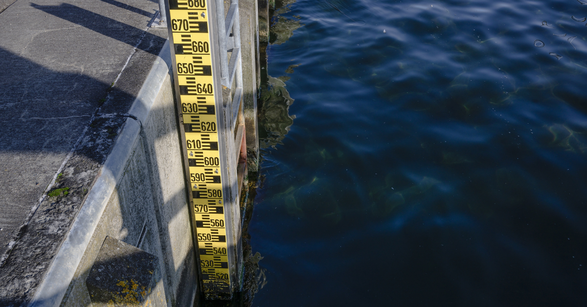
Historically tide gauges worked by observing the rise and fall of the water level, either by eye and recording the level against a calibrated pole (a tide pole) or by etching a line on a piece of paper to record the rise and fall of a float in the water. Today the measurements are made using remote sensors that continuously record the height of the water level and send it back to a digital storage facility. Over time, enough data can be acquired to review, analyse and then to predict future tidal levels.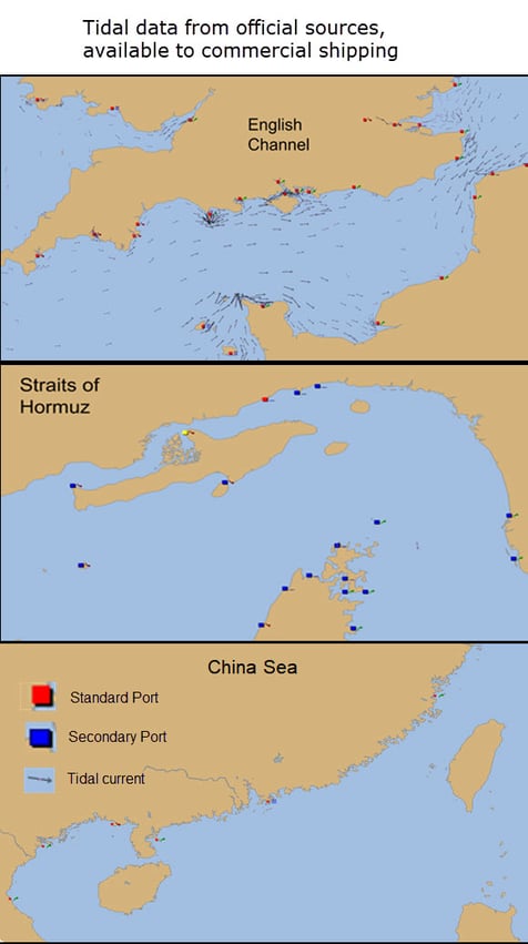
However, knowing tidal levels does not generally provide sufficient information to predict tidal currents. Additional factors add complexity to tidal currents; variations in depths, changes in coastlines, and storm-driven winds can easily change the currents and make any prediction less accurate.
Measurements at a tide gauge are only accurate at that location and a short distance away. There are very few offshore tide gauges and tidal stream atlases are often based on sparse observations, sometimes short period measurements taken more than 100 years ago. As it's not practical to take mass, long time-series measurements of current offshore, we have had, until recently, a lack of proper and in-depth tidal information around the world, with most of the available information concentrated around North-West Europe and the USA. Outside of these regions, the available data is almost non-existent.
These days there are additional ways to gaining information about observed surface currents. Fixed moorings and floating buoys provide spot measurements; High Frequency (HF) radar installations measure surface currents across 100's of square km of ocean; satellites carrying altimeters measure the sea surface height from which currents can be deduced (similar to determining winds from atmospheric pressure variations) on a global scale, and sufficient measurements can allow the development of tidal height atlases. However, gaining access to these measurements is not always straightforward and they often do not provide the necessary detail where, and how mariners need it.
What is Tidetech Doing to Change This?
At Tidetech, we are bridging the gap between mariners and the lack of available tidal information by constructing numerical models of tidal elevation and currents, using techniques developed at one of the world's foremost tidal research institutes, the UK National Oceanography Centre.
Our scientists produce high-resolution operational tidal models in-house, utilising the measurements described above, and select the best performing meteorological and oceanographic third-party datasets from official and academic sources to provide the most accurate data in the industry.
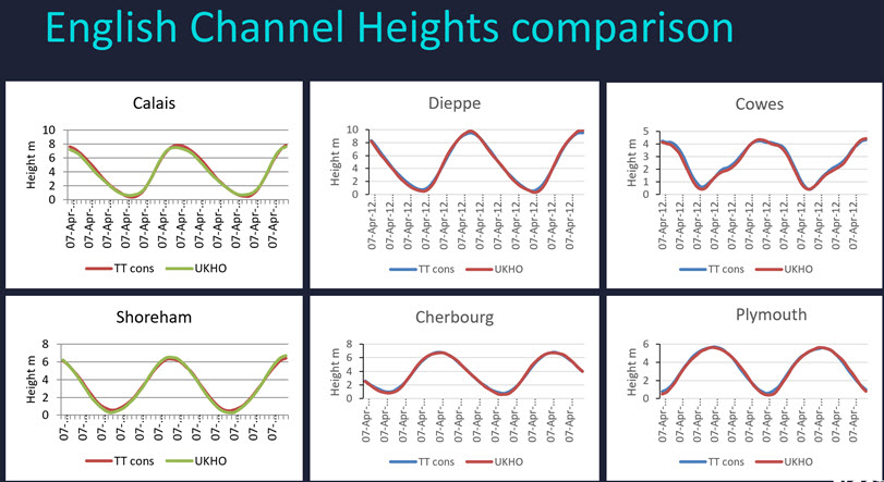
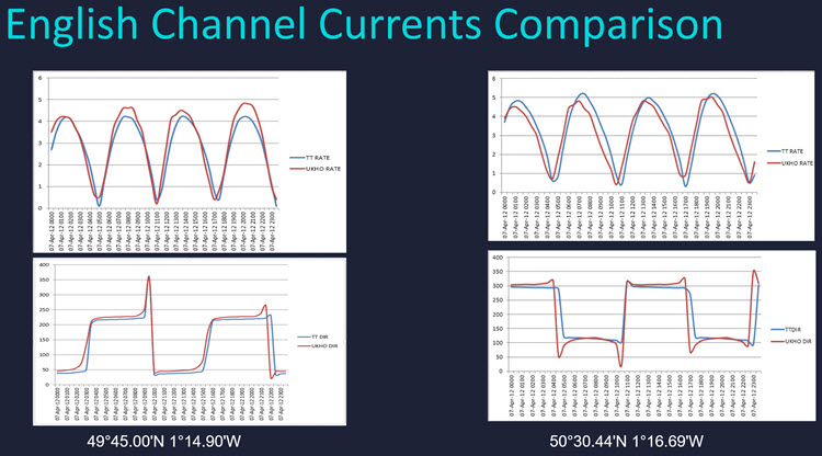
Using this technology, we create hydrodynamic models that not only predict tidal height, but also tidal current direction and speed. The animation below shows Tidetech's Hydrodynamic model of the English Channel compared with predictions derived from an official source, derived from observations.
Validation Data
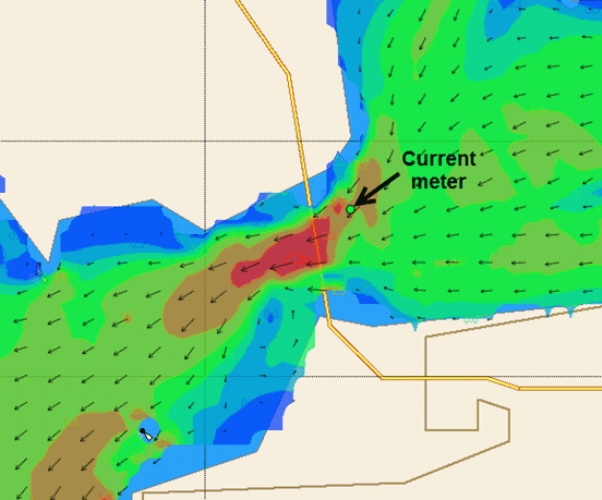
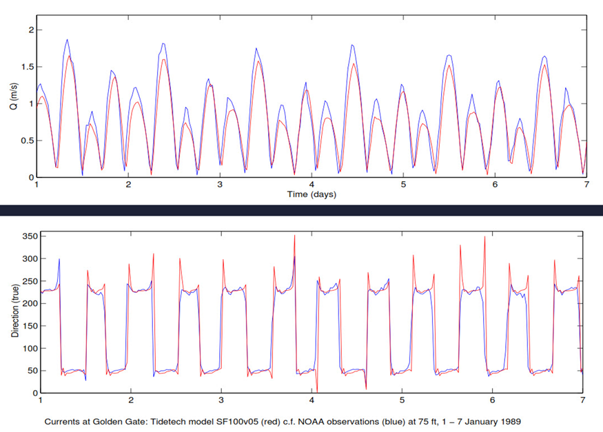
The preferred method of validation is against tidal currents obtained from current meters. Below is an example of validation of Tidetech's high-resolution model for San Francisco Bay.
Unfortunately, only a minimal amount of current meter data is available worldwide due to the challenges of measuring currents in the open sea. You can read more here.
Where current meter data is unavailable, we can validate model output against tidal elevations obtained from tide gauge data analysis, which allows us to provide detailed coverage where tidal information is vitally important. Seeing strong commonalities between two independent sets of data gives us confidence that the validation is correct, meaning a more accurate, more in-depth and wider coverage for all users.
The data we use at Tidetech is derived from scientific institutions and our own models. Our data is a blend of observations and models which are carefully assembled to approximate the actual conditions for sea-level heights, currents and waves occurring at any particular time and place.
Tidetech's offering is unique. In addition to our forecast products, we provide global environmental data for weather, waves and currents dating back to 2014 and high-resolution regional wave and current data dating back 12 months.
So if you're interested in learning more and finding out how Tidetech can benefit your company, get in touch, we'd love to hear from you. Alternatively, you can get access to our global Tidetech data for FREE, below.